Abstract
We review what is known about ecosystem service (ES) delivery from agricultural dykelands and tidal wetlands around the dynamic Bay of Fundy in the face of climate change and sea-level rise, at the outset of the national NSERC ResNet project. Agricultural dykelands are areas of drained tidal wetland that have been converted to agricultural lands and protected using dykes and aboiteaux (one-way drains or sluices), first introduced by early French settlers (Acadians). Today, Nova Scotia’s 242 km system of dykes protect 17,364 ha of increasingly diverse land uses—including residential, industrial, and commercial uses as well as significant tourism, recreational, and cultural amenities—and is undergoing system modernization and adaptation. Different ES are provided by drained and undrained landscapes such as agriculture from dykelands and regulating services from wetlands, but more complex dynamics exist when beneficiaries are differentiated. This review reveals many knowledge gaps about ES delivery and dynamics, including around net greenhouse gas implications, storm protection, water quality, fish stocks, pollination processes, sense of place, and aesthetics, some of which may reveal shared ES or synergies instead of trade-offs. We emphasize the need to be open to adapting ES concepts and categorizations to fully understand Indigenous implications of these land use decisions.
1. Introduction
In the last few decades, North America has seen increased efforts to conserve and restore coastal habitats (e.g., Zedler 2000; Choi et al. 2008; van Proosdij et al. 2010). The northeastern North American tidal wetland area, including that of the Bay of Fundy system, has been in decline for centuries from dyking, drainage, construction, and erosion (Gedan and Silliman 2009). Agricultural dykelands (also called agricultural marshlands) are areas of drained tidal wetland converted to agriculture using dykes and aboiteaux (one-way drains or sluices). In the 1600s, French settlers (called Acadians) to the Bay of Fundy used this technique to develop high-quality farmland in the Canadian provinces of New Brunswick (NB) and Nova Scotia (NS) (Butzer 2002). Currently, dykes protect agricultural production and a wide range of residential, industrial, and commercial uses owing to farmland abandonment and suburbanization as well as significant tourism and recreation (Sherren et al. 2016).
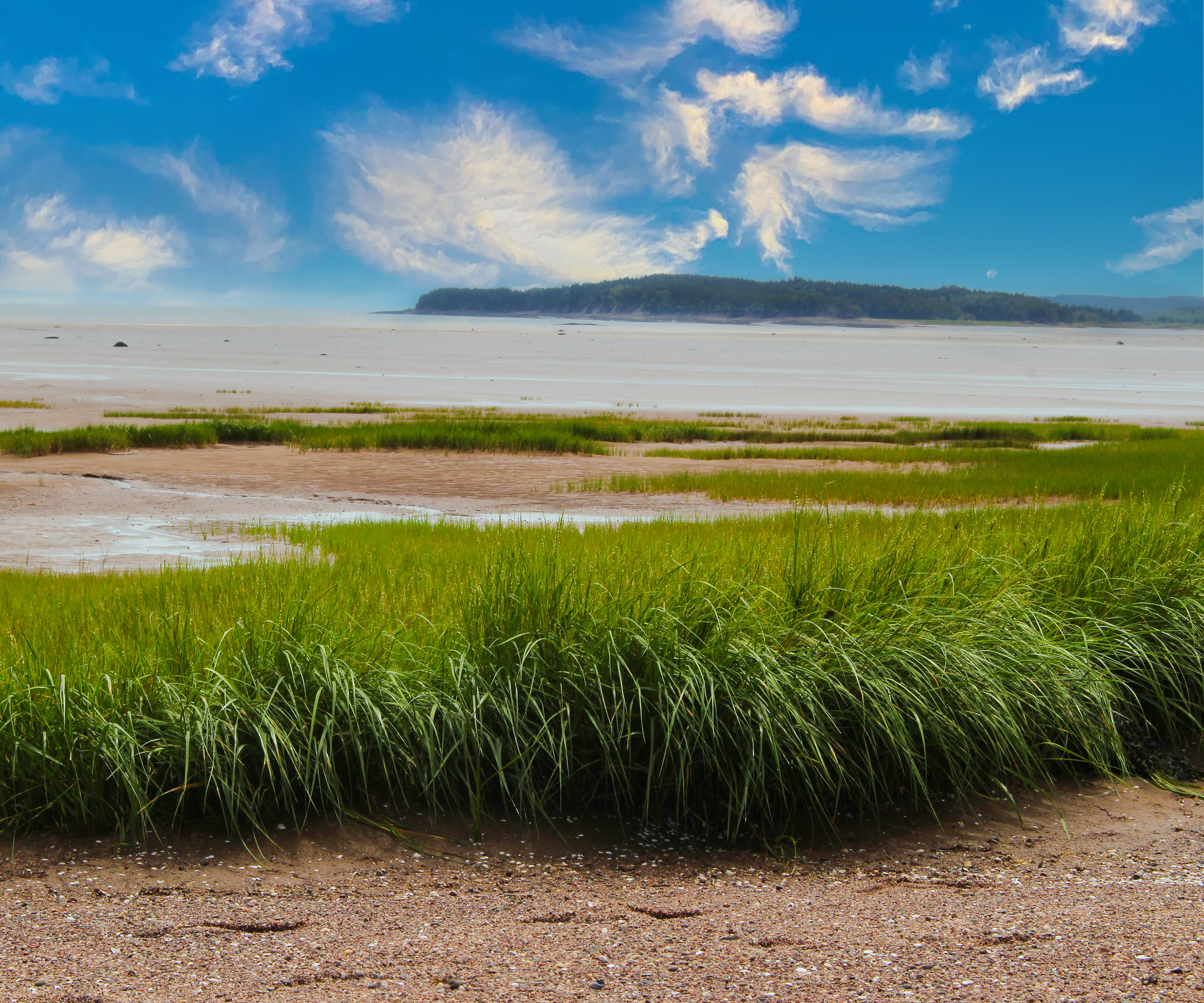
In many areas, current dyke dimensions are inadequate to protect these coastal land uses, given rising sea levels and storm surges expected with climate change (Lieske 2015; van Proosdij et al. 2018b). Such change and land-use dynamics have removed much of the remnant foreshore tidal wetlands (intact wetlands in front of dykes) that once served to protect the dykes themselves (Fig. 1), a process called coastal squeeze. Moreover, starved of rich sediments from the Bay for so long, many dykelands have subsided, making drainage on them increasingly difficult. The decision-makers that manage the dykes must decide where to reinforce, realign (shorten and pull back), or abandon dykes and related infrastructure. Realignment and abandonment of dykes provides opportunities to restore tidal wetland (Singh et al. 2007). Raising dykes to withstand sea-level rise widens footings, exacerbating coastal squeeze, so it cannot be paired with tidal wetland restoration and may in fact further reduce the extant amount. Early discussions of proposed modifications to individual tracts of dykelands have revealed tensions among governments, landowners, and other citizens, as well as challenges to policy coordination among the many government departments whose responsibilities overlap in these coastal landscapes (Rahman et al. 2019).